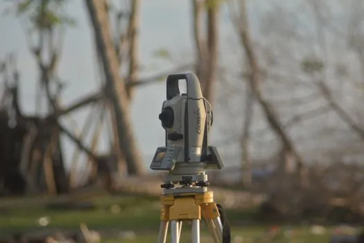
For landscape architects and grading contractors, a total station delivering ±5 arcsecond angular accuracy and ±2 mm + 2 ppm distance precision covers roughly 80% of residential and small commercial landscaping layouts without overspending on robotic one-man systems [S1].
The instrument choice is narrower than for survey-grade engineering work: a mid-range mechanical total station with prism, tripod, and data collector typically runs $8,000 to $15,000 new in 2026, while a robotic total station (Trimble S5/S7/S9 class) sits well above that band and is justified only by daily stake-out volume [S2]. A modern total station is the electronic descendant of the optical theodolite, integrating angle and electronic distance measurement (EDM) into a single computer-readable unit [S4].
Accuracy tiers that actually matter for landscape work
Boundary and as-built surveys on landscaping projects demand angular accuracy of ±5 arcseconds and distance precision within ±2 mm + 2 ppm; topographic mapping tolerates ±10 arcsecond angles because contour spacing absorbs the slack [S1]. Sub-millimeter monitoring accuracy is reserved for dam or bridge deformation, not garden grading, and any spec sheet promising 0.5 mm at 1 km on a landscaping budget is marketing, not engineering.
For typical residential lots (under 1 acre / 4,000 m²), a 2 second total station reading 360° prism shots from two setups closes a traverse well inside the 1:10,000 ratio that most landscape architects need for irrigation and hardscape layout. EDM range of 3,000 m to a single prism is more than enough; what matters more is the 1.5 m minimum focus distance, since flower-bed corner shots often sit close to the instrument.
Manual vs motorized vs robotic: pick by crew size
A manual total station needs a two-person crew (instrument operator plus prism rod), costs least, and is the default for crews running two or three layout jobs a week. A motorized (servo) total station still needs a rod person but locks and traverses on command, cutting re-setup time on multi-day site plans. A robotic total station follows a 360° prism alone, freeing one body to set stakes, which pays for itself only when the daily stake count exceeds roughly 80 to 120 points per day per crew [S2].
GNSS rovers, by contrast, are autonomous satellite-based systems and do not need a fixed reference station; they excel in open terrain but lose lock under tree canopy, which is exactly where most landscape hardscape, irrigation, and planting layout points live [S3]. For tree-lined residential lots, the total station's line-of-sight rule is an asset, not a limitation, because prisms can be held under a closed canopy while a GNSS receiver cannot fix satellites through leaves.
Comparison: manual, motorized, and robotic total stations for landscaping
Three selection criteria separate the three classes cleanly on a 2026 landscaping bid:
Crew size: manual = 2 person, motorized = 2 person, robotic = 1 person on the prism end. Cost band (2026 USD, instrument only): manual $4,000 to $8,000, motorized $9,000 to $18,000, robotic $22,000 to $50,000+ for the Trimble S series [S2]. Typical daily stake-out throughput: manual 40 to 60 points, motorized 70 to 100 points, robotic 100 to 200+ points per 8-hour day. Best-fit site size: manual under 0.5 acre, motorized 0.5 to 5 acres, robotic 5+ acres or multi-crew developments.
Anything below 0.25 acre residential lots with simple rectilinear patios rarely justifies anything beyond a manual unit, because setup time dominates measurement time on small footprints.
Environmental and site constraints specific to landscape sites
Temperature swings of 20°C between morning and afternoon on a blacktop driveway shift a non-temperature-compensated instrument visibly; specify a model with built-in atmospheric correction or budget for on-site ppm entry from current temperature and pressure readings. Dust from grading equipment and sprinkler mist force an IP54 or higher rating on the instrument and at minimum splash-resistant covers on the data collector. [S1]
For [total station](encyclopedia/total-station.html) work on finished lawns and planting beds, a fiberglass tripod with rubber feet prevents lawn damage that an aluminium spike tripod would cause on soft turf. The same [total station](encyclopedia/total-station.html) used for layout is then redeployed for as-built pickup once the irrigation contractor finishes, which is why EDM accuracy and data export to CSV/DXF matter more than Bluetooth pairing gimmicks.
When a total station is the wrong tool
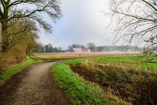
For open-field site grading of more than 20 acres with no overhead canopy, a GNSS rover is faster, requires fewer setups, and a single operator can drive the boundary while a second walks feature shots [S3]. For interior landscape work inside a glass atrium or greenhouse, neither total station nor GNSS works; switch to a handheld laser distance meter (50 m range class) for bench and planter layout. For design-phase concept sketching rather than construction layout, hand-measured offsets and a tape are still faster than any instrument.
Specifying a robotic total station for a crew that runs one hardscape layout a week is the most common waste on landscaping bids; the depreciation per point staked runs three to five times higher than a manual setup. Conversely, specifying a manual unit for a 40-acre master-planned community landscape package guarantees lost days on stake-out, which is why the selection matrix in the previous section is built around daily point count, not site area alone.
Standards, calibration, and what to verify before sign-off
No single ISO standard governs landscaping layout tolerances, but two practical rules dominate field practice. First, the instrument's two-collimation (2C) and vertical index errors should be checked on a known baseline at the start of each project day using the on-board calibration routine, because mechanical drift is the leading cause of missed 1:10,000 closure on landscape projects. Second, ALTA/NSPS-style accuracy documentation is the most cited reference for property-line work and should be requested whenever a landscaping layout ties to a recorded boundary [S1].
For data handoff to irrigation or hardscape subcontractors, confirm the total station exports to LandXML or DXF natively; Trimble Access, Spectra Survey Pro, and equivalent field software handle this, but older non-exporting firmware is a common trap on used 2010-era units that still pass cosmetic inspection.
Adjacent selection tracks for layout work
For crews that already own a total station but need an instrument for indoor plumbing rough-in, the Total Station Selection for Plumbing Installation: 2026 Spec Map covers the very different tolerance and line-of-sight constraints inside a building shell. For hardscape and paver layout where string lines still dominate, the Total Station Spec Map for Masonry Layout: 2026 Selection Guide is the closer companion read, with comparison numbers for ±1 mm and ±2 mm EDM classes. A broader site-prep process map for large grading and trenching equipment is covered in the Agricultural shield machine selection: spec map for field-scale soil work in 2026 reference, useful when the landscaping package includes utility trenching. [S4]
Track the next 60 to 90 days for two signals: (1) the autumn 2026 release cycle of Trimble Access and Spectra Survey Pro, which historically added direct LandXML round-trips with AutoCAD Civil 3D, and (2) any 2026 Q3 firmware updates to mid-range total stations that enable cloud stake-out file sharing, since both materially change the productivity delta between manual and robotic classes on landscaping-scale work.
The underlying component specifications are covered under total station, weather station, and eye wash station.